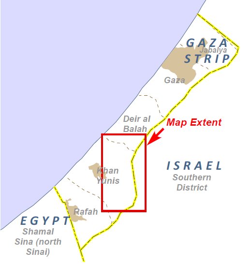
  Palästina - Israel home |
Gaza-Karten/
maps
2008/2009 und 2014
Die
Zerstörung Gazas /
The destruction of Gaza
Siehe auch Karten 2014/2 mit
zusammengesetzten 'Gaza
Crisis Atlas'-Karten
und interaktiven CartoDB-Karten /
see also maps 2014/2 with assembled 'Gaza Crisis Atlas' maps
and interactive CartoDB maps
Karten und Satellitenaufnahmen von UNOSAT, Daten zum Teil auf OpenStreetMap-Karten übertragen /
maps and satellite photos published by UNOSAT, some of the data transferred to OpenStreetMap
Siehe auch New York Times: "Assessing the Damage and Destruction in Gaza" und
OCHAOPT-Gaza Crisis Atlas (15.8.14)
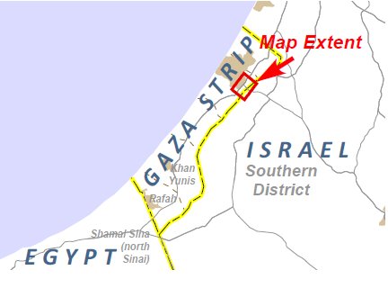
Die fortschreitende Zerstörung Gazas anhand des Beispiels
Nordost-Seite von Gaza-Stadt /
The increasing destruction of Gaza showing in the example of
the northeast side of Gaza City.
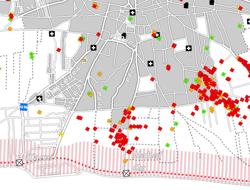
Israelischer Angriff / Israeli attack 2008/2009
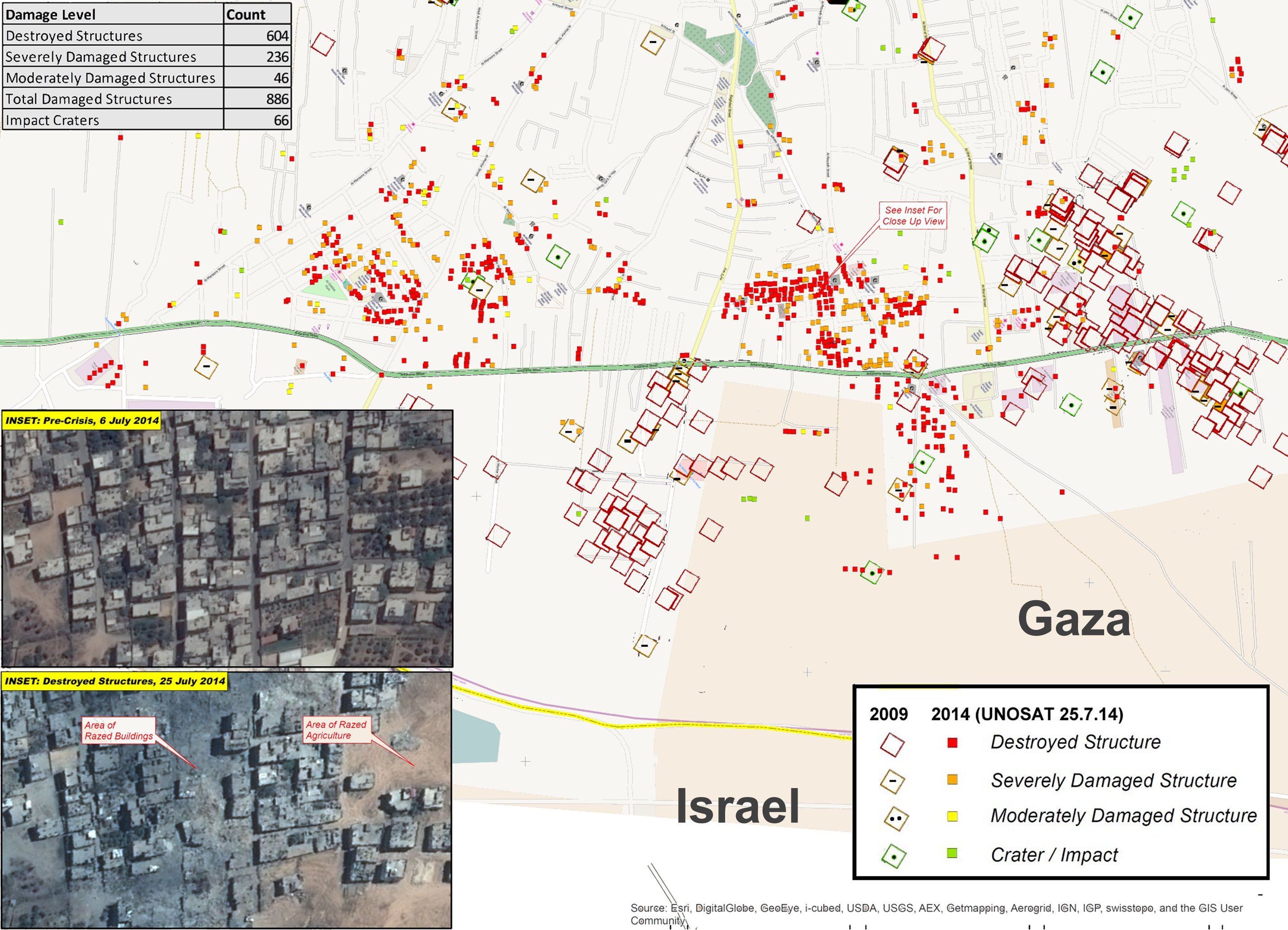
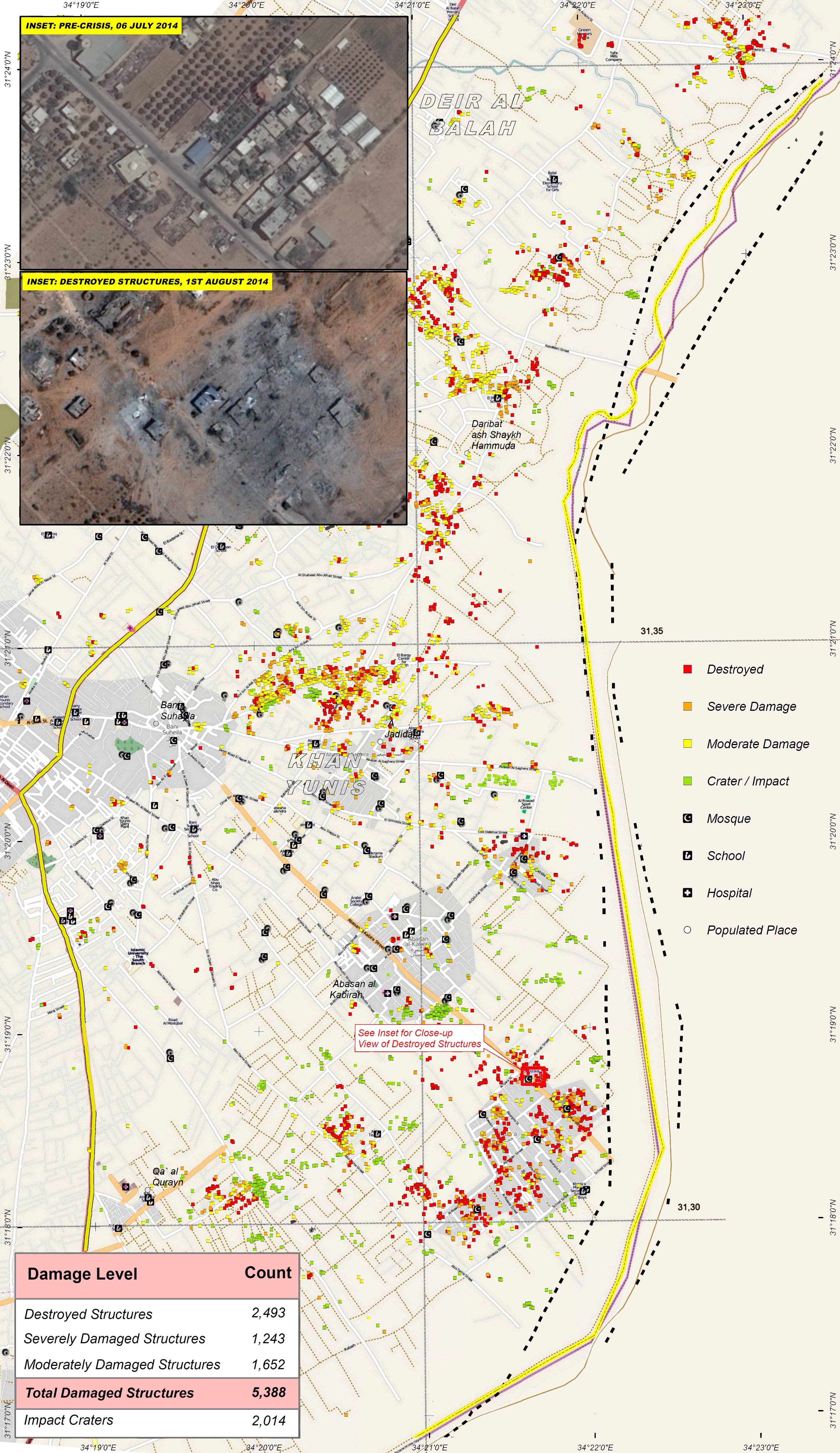
Im Jahr 2009 veröffentlichte die UN Karten, in denen die Zerstörungsorte markiert waren. /
In 2009 the UN published maps in which the destruction sites were marked.
Die hier gezeigte Karte ist ein Ausschnitt aus der zweiten Karte.
Sie ist wie alle folgenden um etwa 50° gedreht. /
The map shown here is a detail of the second map.
It is, as all the following, turned by about 50°.
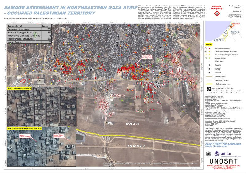
Israelischer Angriff / Israeli attack 2014
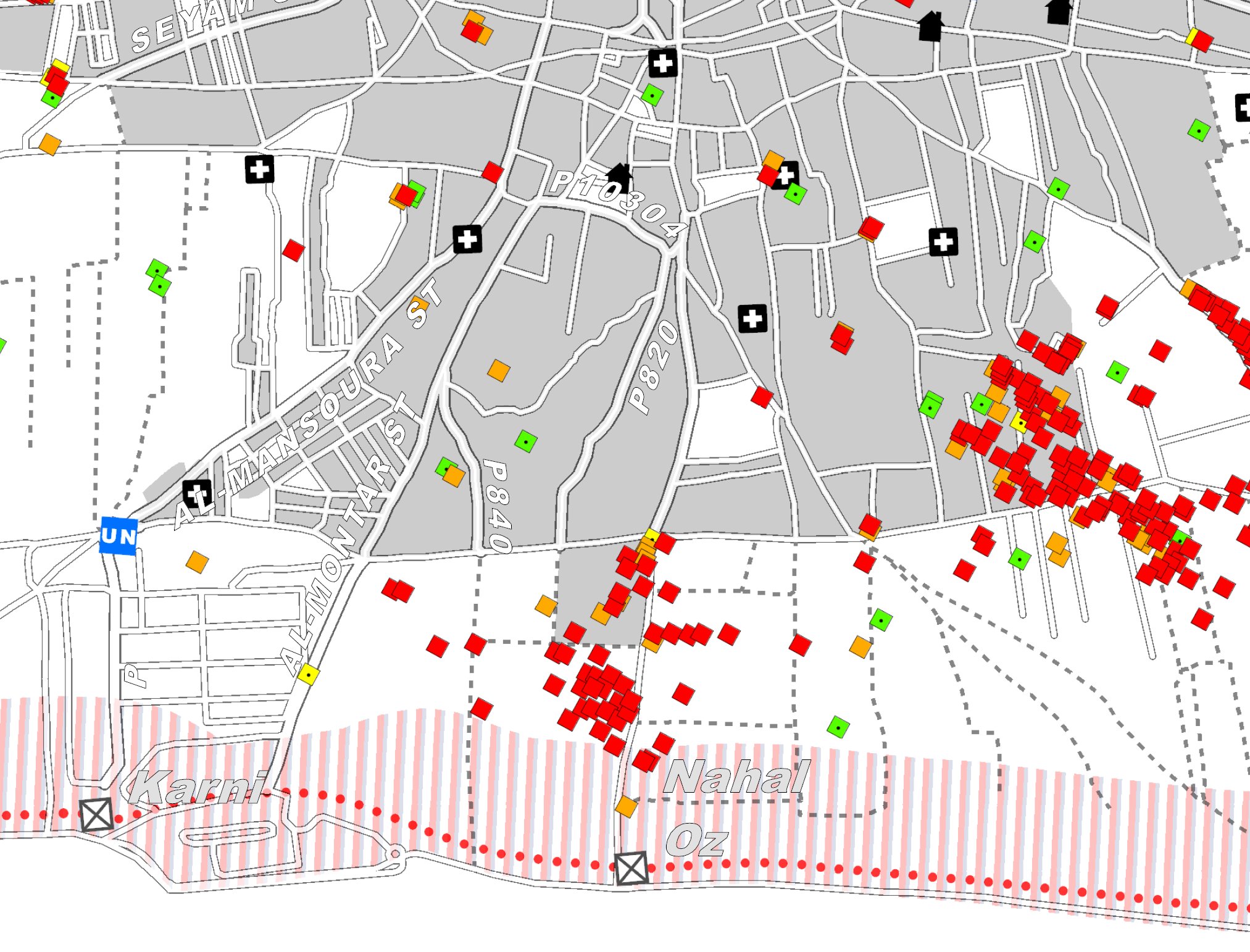
UNOSAT veröffentlichte für dieses Gebiet und andere Gebiete entsprechende Karten /
UNOSAT published corresponding maps for this and other areas.

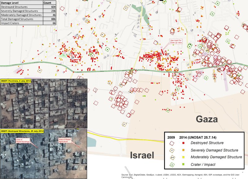
Die folgende Karte ist eine Überlagerung beider Karten /
The following map is a superposition of the two maps
Zerstörungsdaten übertragen in OpenStreetMap /
destruction data transferred to OpenStreetMap
Über irevolution.net:
'Aerial footage captured by a small civilian UAV/drone shows the scale of the
devastation caused by Israeli bombardment during the recent conflict.
Media Town, a Palestinian-based production company, flew their DJI Phantom2 quadcopter
with a GoPro Hero+3 camera over Gaza City’s eastern suburb of Al-Shejaiya ... .'
Die folgenden Bilder sind korrespondierende Satellitenaufnahmen (Google Earth) /
the following images are corresponding satellite images (Google Earth)
2007
2011
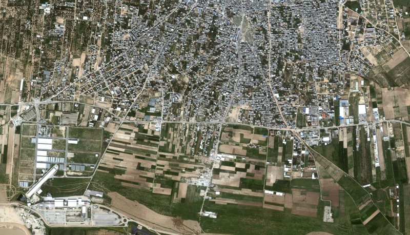
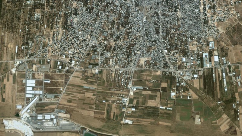
Als weiteres Beispiel / as another example Khuza'a und Al Qarara
Google-Karten für dieses Gebiet sind auf dem Stand von 2007 /
Google maps for this area were last updated in 2007
Hilfslinien und Moscheensymbole geben einen Hinweis auf die Genauigkeit der Übertragung /
reference lines and symbols for mosques give an indication of the accuracy of the transfer

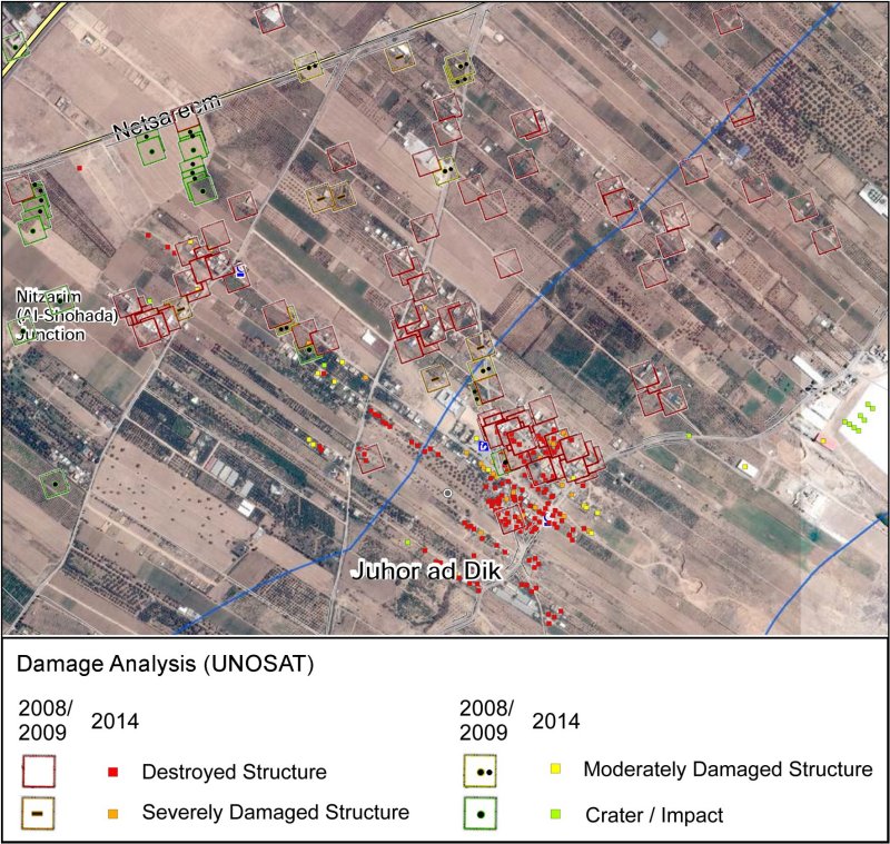
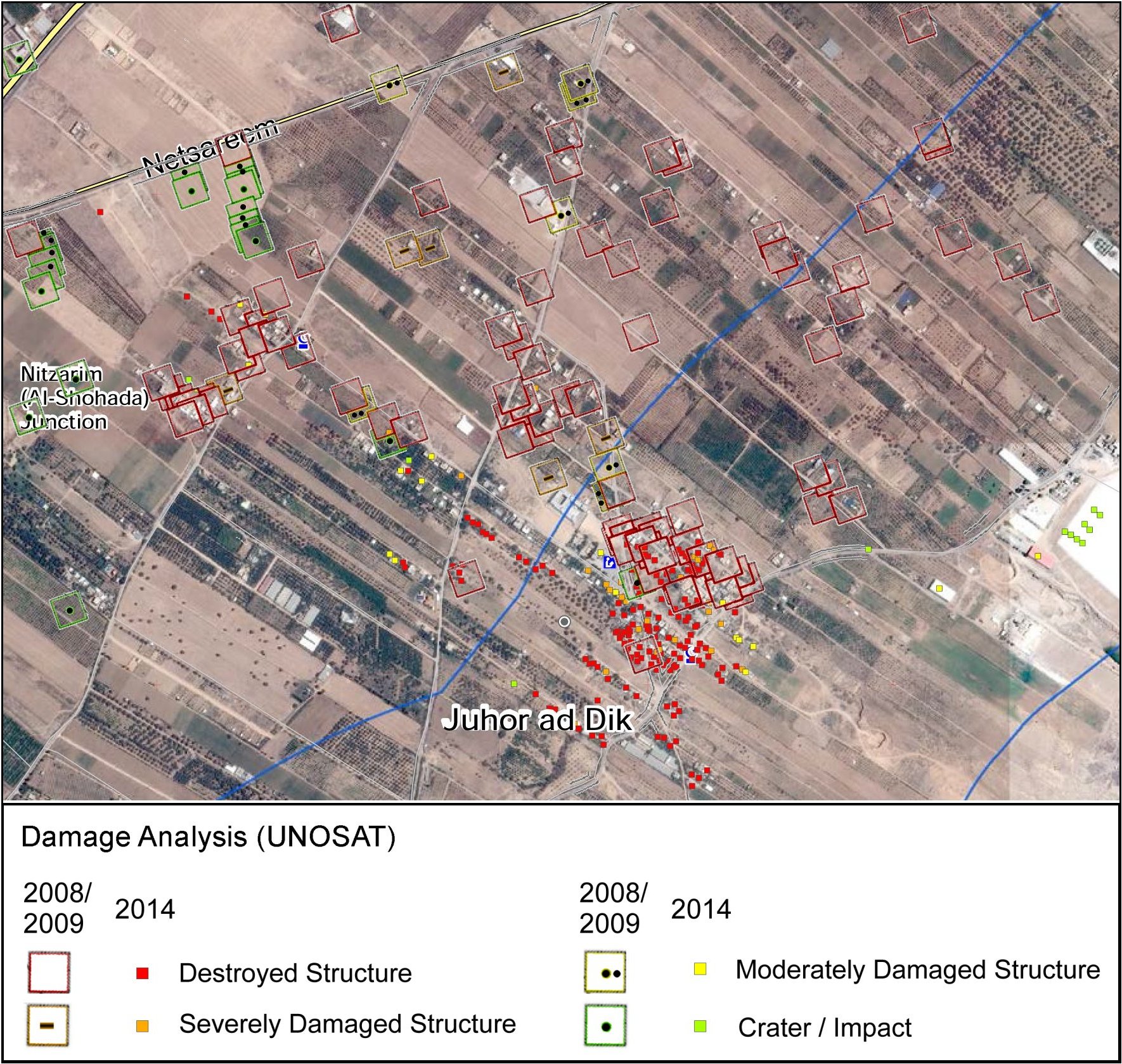
Juhor ad Dik was already severely damaged in 2008 / 2009
(s. Panorama Juhor ad Dik 2009)
Zerstörungskarte aus / destruction map from Gaza Crisis Atlas 2014
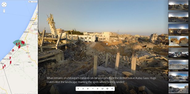
20 Panorama - Bilder / images
im August 2014 aufgenommen von / taken by Lewis Whyld
nächste/ next
2008/2009 und 2014
Die
Zerstörung Gazas /
The destruction of Gaza
2008/2009,
(2012), 2014
Siehe auch Karten 2014/2 mit
zusammengesetzten 'Gaza
Crisis Atlas'-Karten und interaktiven CartoDB-Karten /
see also maps 2014/2 with assembled 'Gaza Crisis Atlas' maps
and interactive CartoDB maps
Karten und Satellitenaufnahmen von UNOSAT, Daten zum Teil auf OpenStreetMap-Karten übertragen /
maps and satellite photos published by UNOSAT, some of the data transferred to OpenStreetMap
Siehe auch New York Times: "Assessing the Damage and Destruction in Gaza" und
OCHAOPT-Gaza Crisis Atlas (15.8.14)
Die fortschreitende Zerstörung Gazas anhand des Beispiels
Nordost-Seite von Gaza-Stadt /
The increasing destruction of Gaza showing in the example of
the northeast side of Gaza City.
Israelischer Angriff / Israeli attack 2008/2009
Im Jahr 2009 veröffentlichte die UN Karten, in denen die Zerstörungsorte markiert waren. /
In 2009 the UN published maps in which the destruction sites were marked.
Die hier gezeigte Karte ist ein Ausschnitt aus der zweiten Karte.
Sie ist wie alle folgenden um etwa 50° gedreht. /
The map shown here is a detail of the second map.
It is, as all the following, turned by about 50°.
Israelischer Angriff / Israeli attack 2014
UNOSAT veröffentlichte für dieses Gebiet und andere Gebiete entsprechende Karten /
UNOSAT published corresponding maps for this and other areas.
Die folgende Karte ist eine Überlagerung beider Karten /
The following map is a superposition of the two maps

Zerstörungsdaten übertragen in OpenStreetMap /
destruction data transferred to OpenStreetMap
Über irevolution.net:
'Aerial footage captured by a small civilian UAV/drone shows the scale of the
devastation caused by Israeli bombardment during the recent conflict.
Media Town, a Palestinian-based production company, flew their DJI Phantom2 quadcopter
with a GoPro Hero+3 camera over Gaza City’s eastern suburb of Al-Shejaiya ... .'
Die folgenden Bilder sind korrespondierende Satellitenaufnahmen (Google Earth) /
the following images are corresponding satellite images (Google Earth)
2007

2011

Als weiteres Beispiel / as another example Khuza'a und Al Qarara
Google-Karten für dieses Gebiet sind auf dem Stand von 2007 /
Google maps for this area were last updated in 2007
Hilfslinien und Moscheensymbole geben einen Hinweis auf die Genauigkeit der Übertragung /
reference lines and symbols for mosques give an indication of the accuracy of the transfer
Juhor ad Dik
Juhor ad Dik wurde bereits 2008/2009 stark zerstört /Juhor ad Dik was already severely damaged in 2008 / 2009
(s. Panorama Juhor ad Dik 2009)
Zerstörungskarte aus / destruction map from Gaza Crisis Atlas 2014
20 Panorama - Bilder / images
im August 2014 aufgenommen von / taken by Lewis Whyld
nächste/ next