
home
| |
Palästina
- Israel home |
PalisD |
|
My third visit to Gaza
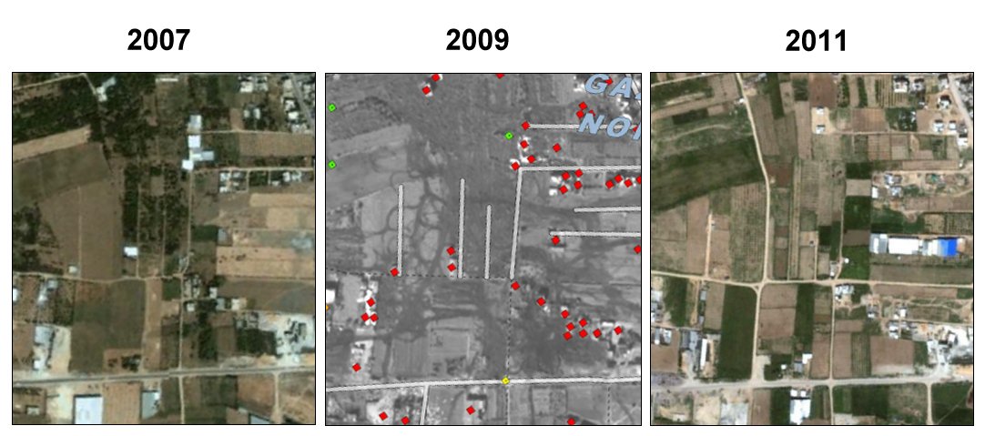
April 21 to May 3, 2012 Peter Voss 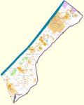 Gaza maps: 'OpenStreetMap', 'destruction'; 'no-go'; 'satellite': Google Earth oder Google Maps, else (28 MB) To assist the commission of the United Nations on the Gaza conflict, the satellite division of the United Nations (UNOSAT) in July 2009 published a detailed report on some key points of the destruction during the Israeli operation "Cast Lead". These core areas were at the border at Rafah, Samouni Street, the area around Al Atatra in the north of Gaza City and Izbet Abbed Rabbo (Abu Drabo) to the east of the city. At Abu Drabo I had passed in 2010 along Al Karama Street. Now I was interested in how things may have changed there during the three years after the attack. The next image shows a portion of the UNOSAT image of Abu Drabo. Each red diamond denotes a destroyed building. 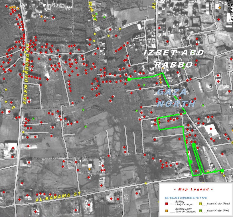 I took a taxi whose
driver
apparently did not know Saleh Dardona St. (at least the way I
pronounced the name; SD St. is on the left side of the image) and ended
up at the intersection
of Al-Quds Street with Al-Karama Street (to the far right in the image
below), where I got out. From there I walked along the path marked
green in the image.
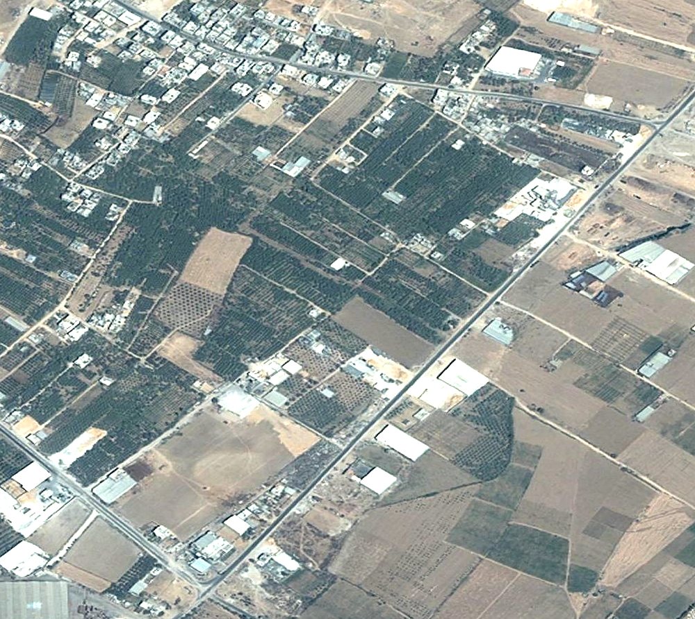
Searching satellite images of this area I found GoogleMaps images of the years 2007 and 2011, but I also found an obviously older aerial photo at Microsoft Bing in an oblique view and in plan view. It shows a tree plantation landscape which in in 2007 had largely disappeared - for whatever reason. Striking to me is how clearly Al Karama Street shows up, which these days is largely silted up. |
 diagonally Al-Karama Str., to the left Saleh Dardona Str. and up Al Quds Str. |
|
First I compare the UNOSAT image of 2009 with the images of 2007 and 2011. The middle images are always excerpts of the UNOSAT image. 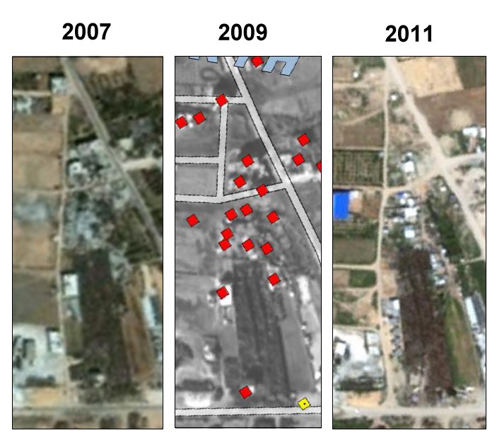 Particularly striking
are the
changes in the landscape in the following sequence of images. The
structures have been partially significantly altered. Here again it can
not be overlooked how fields and roads were devastated in 2009.
|
 |
|
A more enlarged
excerpt from the
Bing image (plan view), shows how many buildings were lost in the
central region of this section, also - as we shall see – what
was
left over were not always houses.
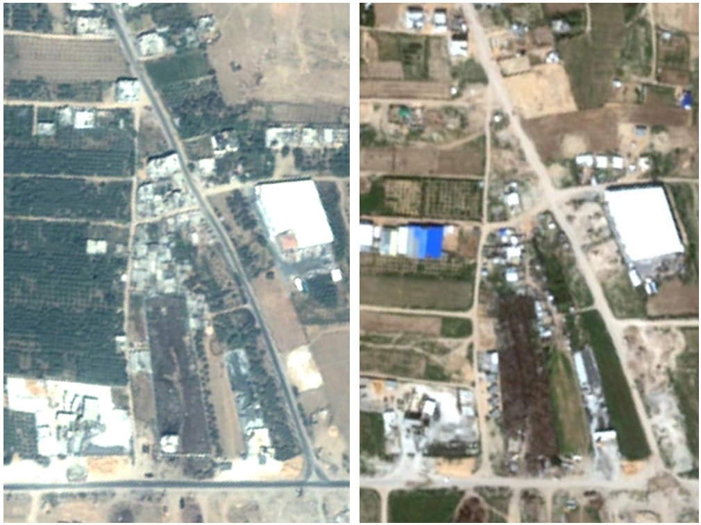 'Bing' image (probably before 2007) and Google Maps 2011 |
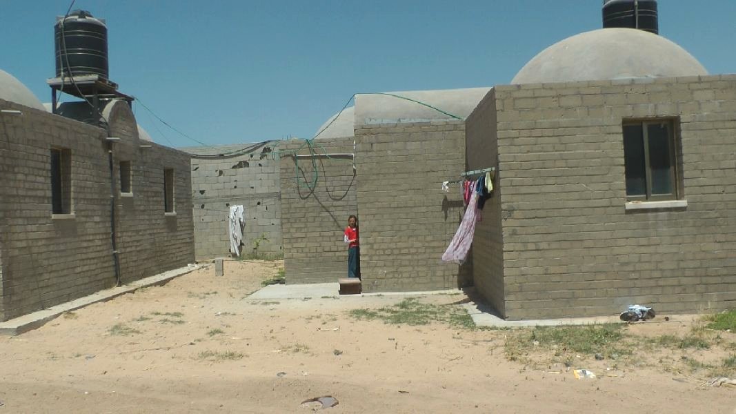
As mentioned, I got off at Al Karama Street (all the way to the bottom right in the images). This area is called Shijaeya. I first looked around and then tried to decide which way to proceed. The area did not look very inviting for a stroll.  Panorama at Al Karama Street At
the location where I got out, there is a commercial operation which
manufactures concrete blocks which apparently are (also) made from the
remains of destroyed buildings (see Report 2010). Between this business
and the next, of which a wall can be seen in the background of the
photo, there was a somewhat neglected looking field. At the end of this
field I saw emergency shelters from a distance and decided to have a
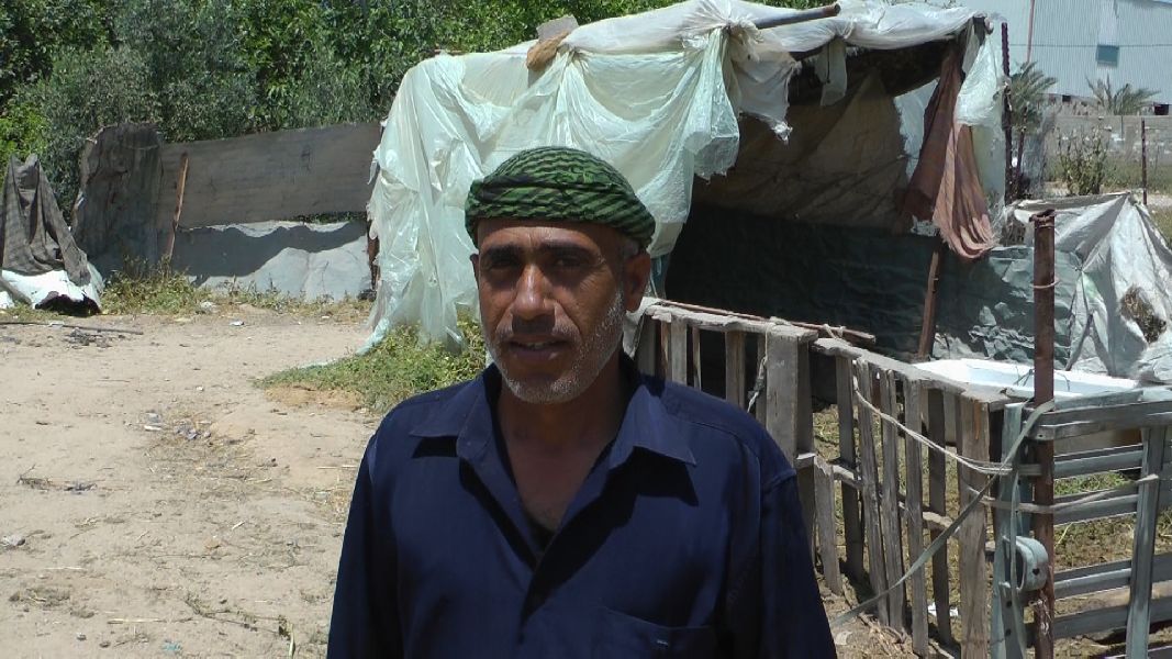
closer look. On the way there I met one of the residents who guided me.
When we reached the little settlement, we met another resident. The
camera in my hand was sufficient for the offer to me to have a look at
their housing complexes. These always seemed to consist of several huts
arranged around a courtyard.
I accompanied the man who had arrived last to the nearest complex. 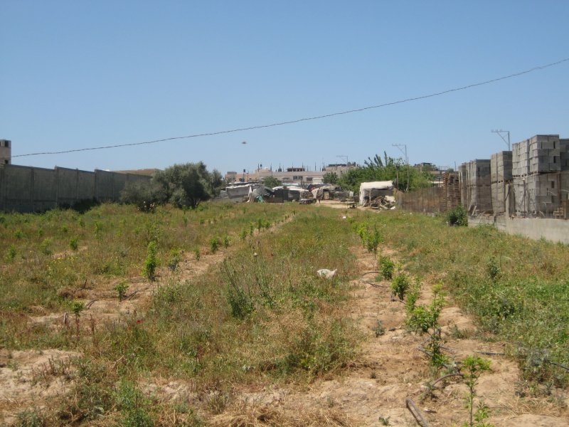
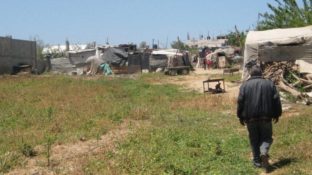
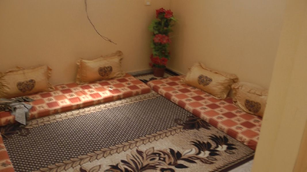
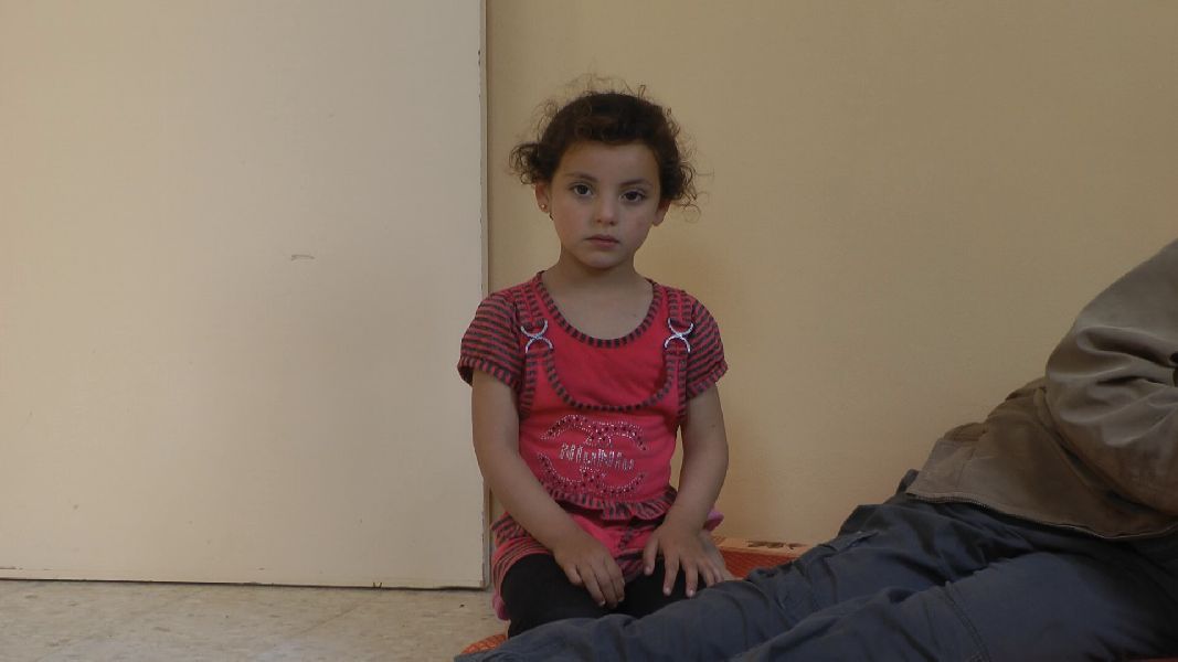
 From one of the videos I have recorded here I put together a panorama. 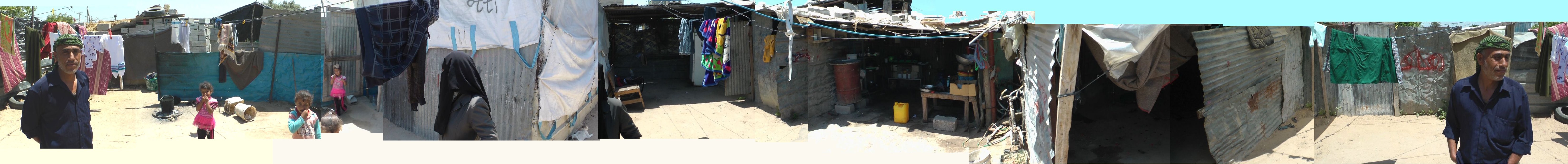 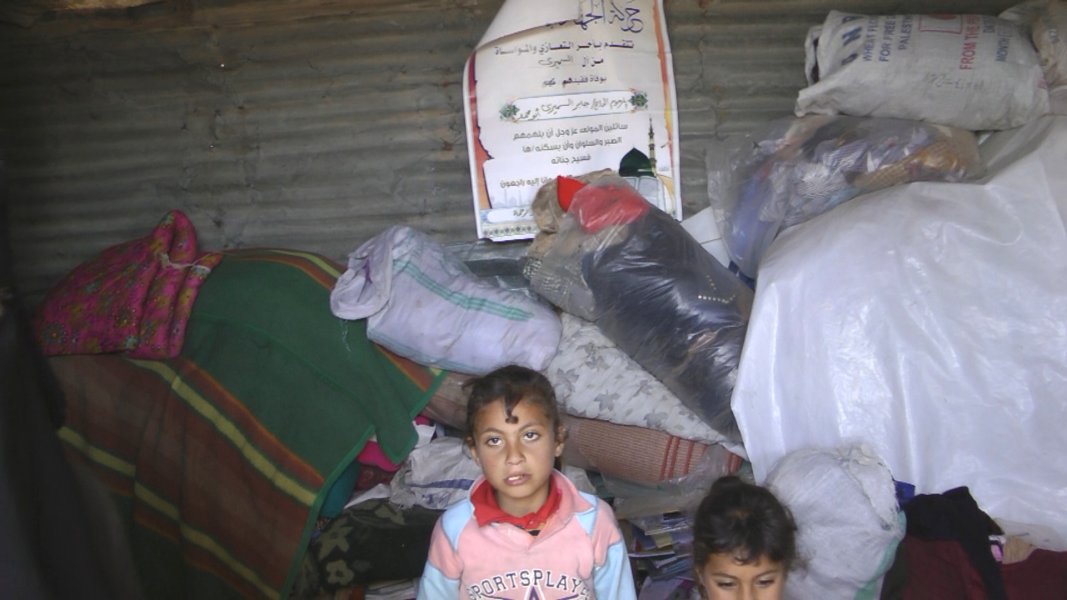 I
also had a look at one of the rooms. A deeply veiled girl who spoke
some English told me that 11 people were sleeping in this small space.
The bedding was piled high against the walls, a sight that I should see
more often. I
also had a look at one of the rooms. A deeply veiled girl who spoke
some English told me that 11 people were sleeping in this small space.
The bedding was piled high against the walls, a sight that I should see
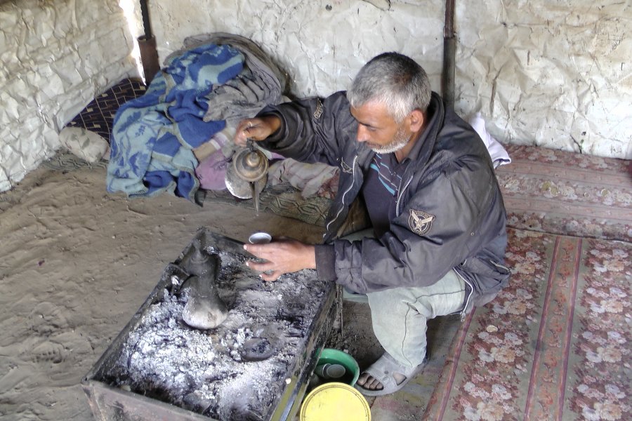
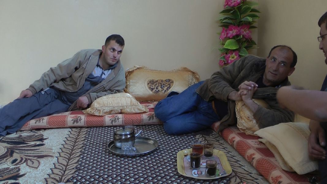
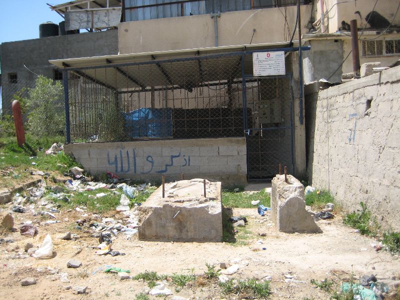
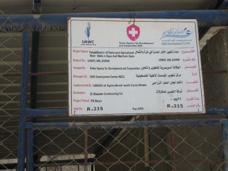
more often.It was obviously a farmers property. I met this farmer later again when he and his son drove along a dirt road on a donkey cart. 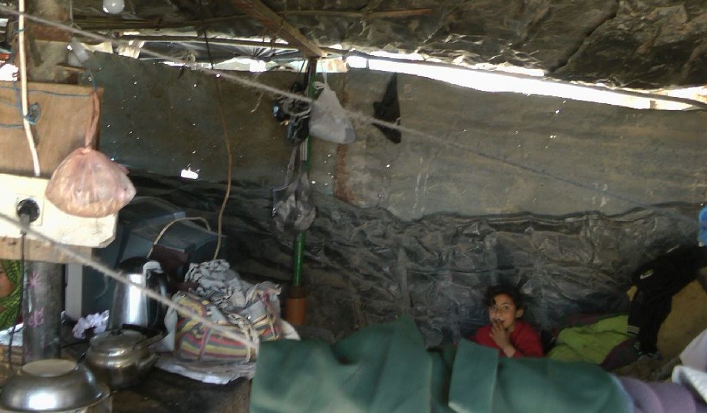 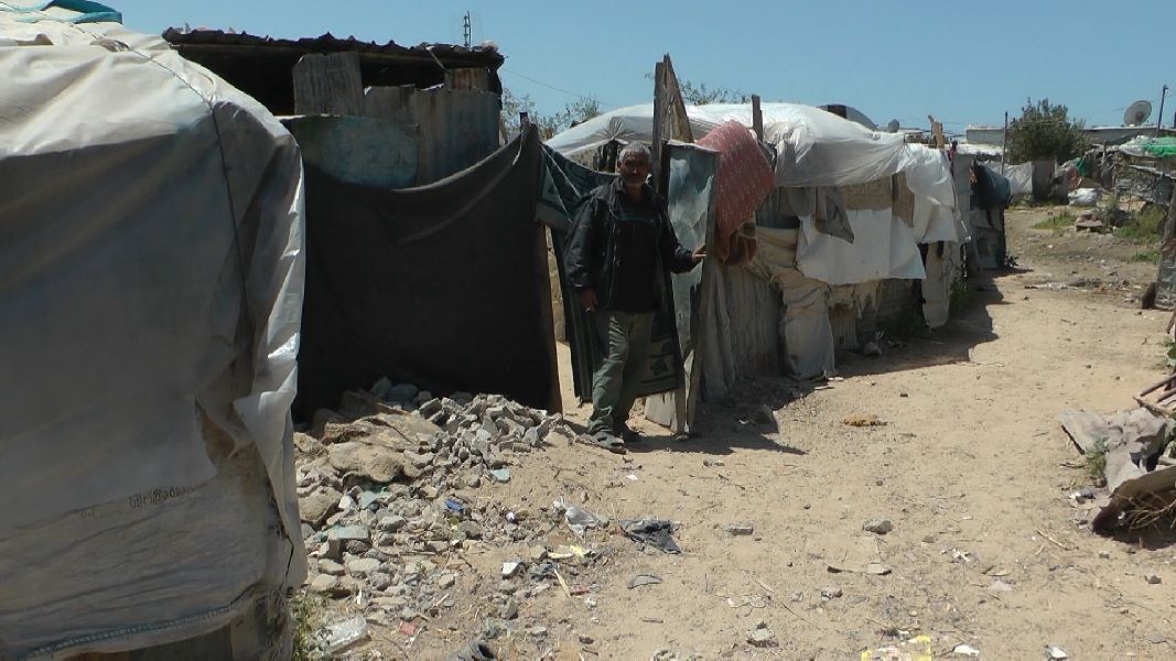 I went back outside, where the second farmer was waiting for me to show me his homestead. Again, an emergency shelter filled with bedding, with a woman and several children in them, very airy, with perforated walls. One must keep in mind that in winter it rains and can be quite cold. The somewhat cumbersome composite panoramic image shows to the right the base plate and the rest of the wall of a house, behind it a large tin shed, which apparently serves as a kitchen. 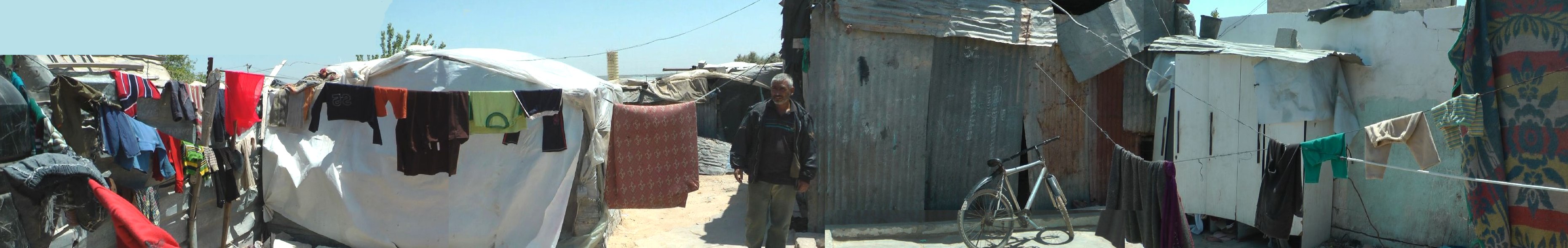 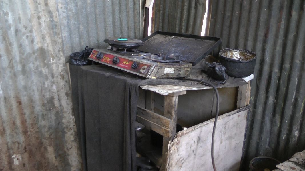 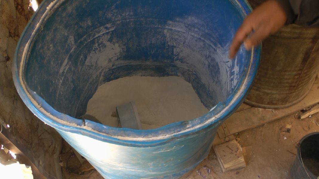 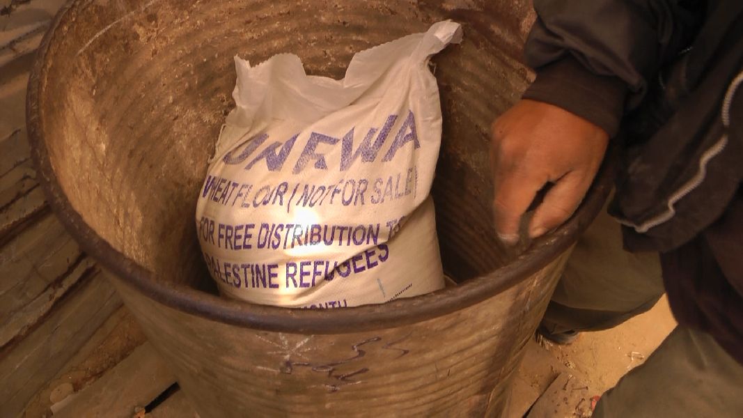 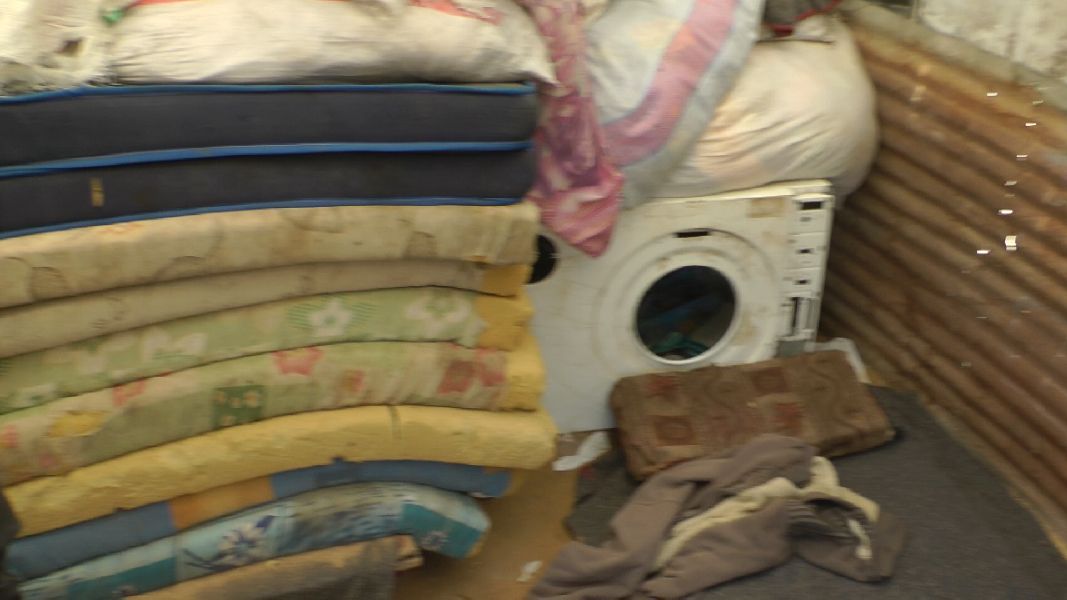 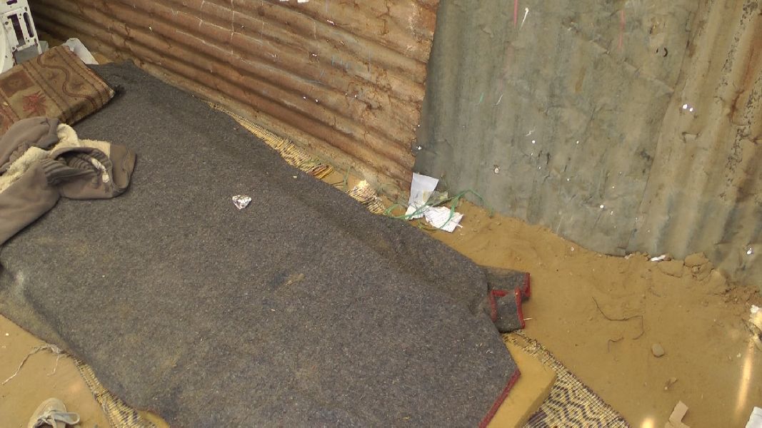 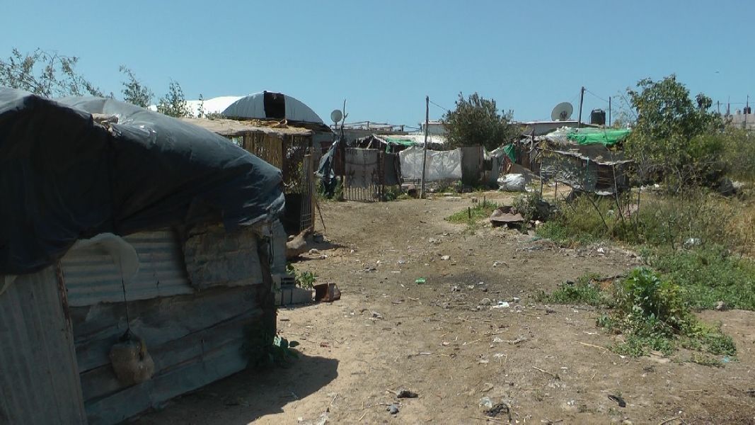 The farmer took me to the white tent, which contained several barrels. In one of the barrels was flour in the other a flour sack, the caption of which pointed to the source: UNRWA, wheat, for free distribution to Palestine refugees. I wrote about this food distribution by the UNRWA agency of the United Nations already in my report of 2010 and further down will come back to it. In any case, it was clear that this family belonged to the descendants of Palestinians who about 64 years ago were expelled or fled to Gaza. The refugees in Gaza make up about 75% of the population and are to a very considerable extent dependent on food assistance. In this room there were also many mattresses piled up high. In one corner stood the ruins of a washing machine. I once again saw a much older ruin. It must have some significance. Behind the homestead were similar properties. In front of them was an area overgrown with trees and shrubs, behind which a larger tent like construction was visible which seemed to have some significance, the meaning of which escaped me. I suspect that it was a cattle barn. At the end of the green belt was a new building on the opposite side of a road. A similar one I had already seen at Samouni Street. I walked past it later. 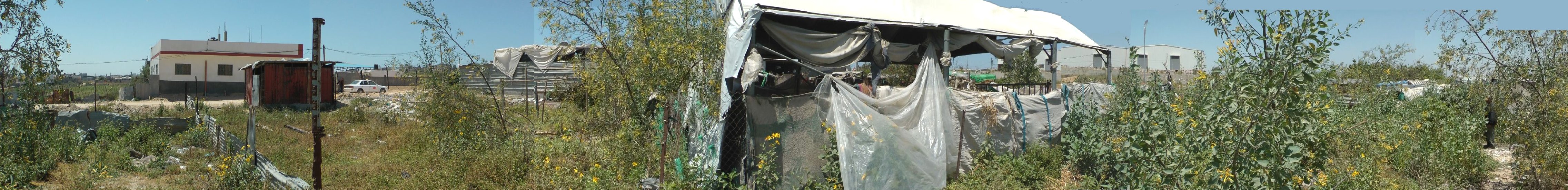 Before I continued my walk I naturally had to drink a glass of tea, and the farmer showed me another hut, which apparently was the Community Coffeehouse. 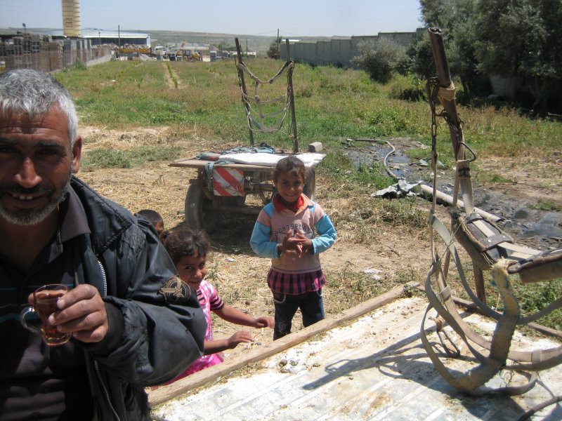
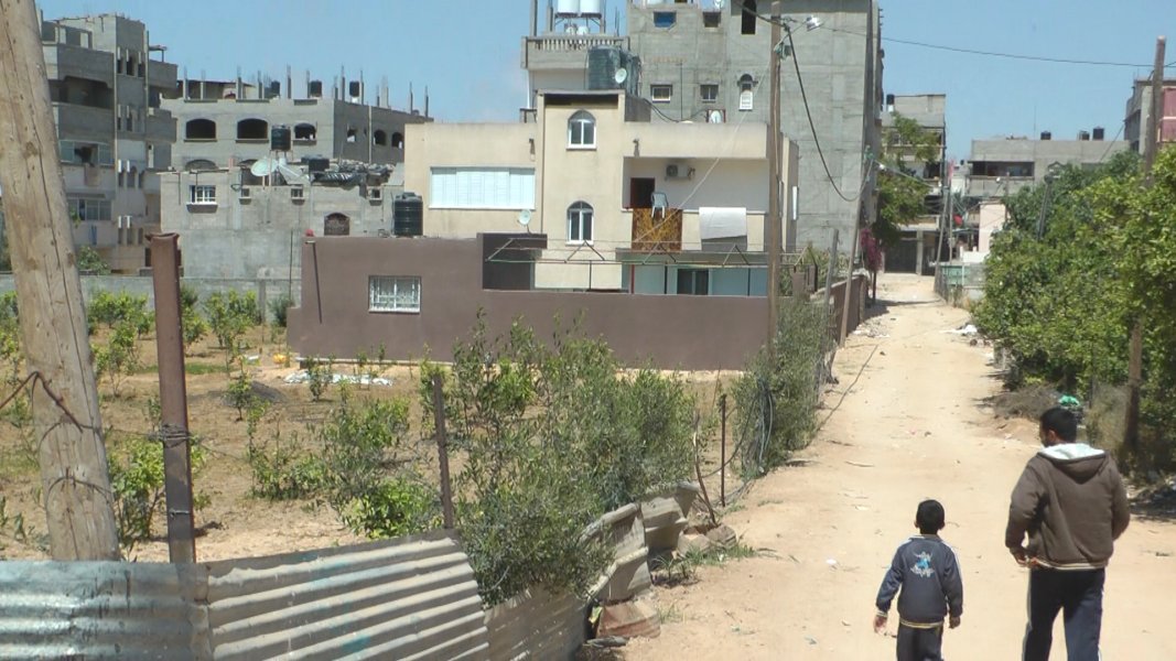
 I set off again, back to Al Karama Street and into the next dirt road. On the satetellite image of 2011 four small houses are clearly visible on one side of the road, evidently shelters. As I later found out they were examples of UNRWA 'mud' houses, i.e. of houses that are built of mud bricks, even though clay is apparently not so easy to find in Gaza and when a few steps away even two years ago there were stacks of concrete blocks. In any case, UNRWA has built 270 such houses. Outside one of the houses stood a resident, who noticed my interest and asked me into his house. I looked around briefly and then had a guilty conscience because I turned down the invitation to a tea, because I did not have much time left. 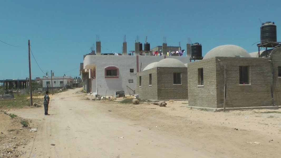
 I returned a few days later with an English speaking taxi driver and made good for it. 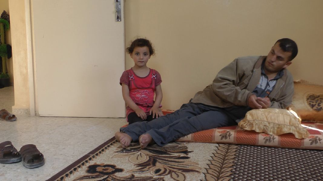
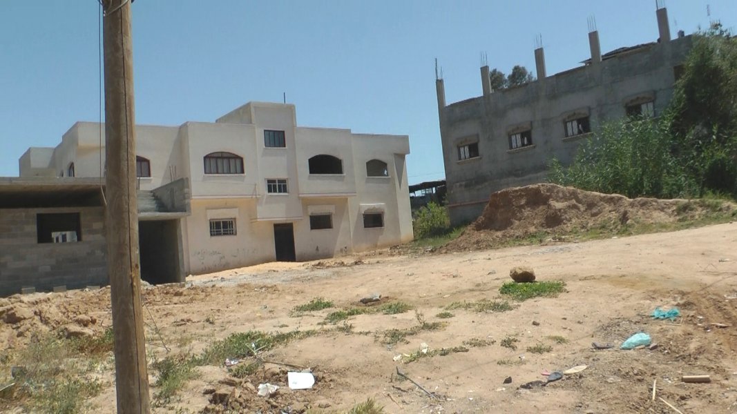
 A little further along this path were ordinary houses under construction or completed. At the next junction, I took another panorama of the shanty village. 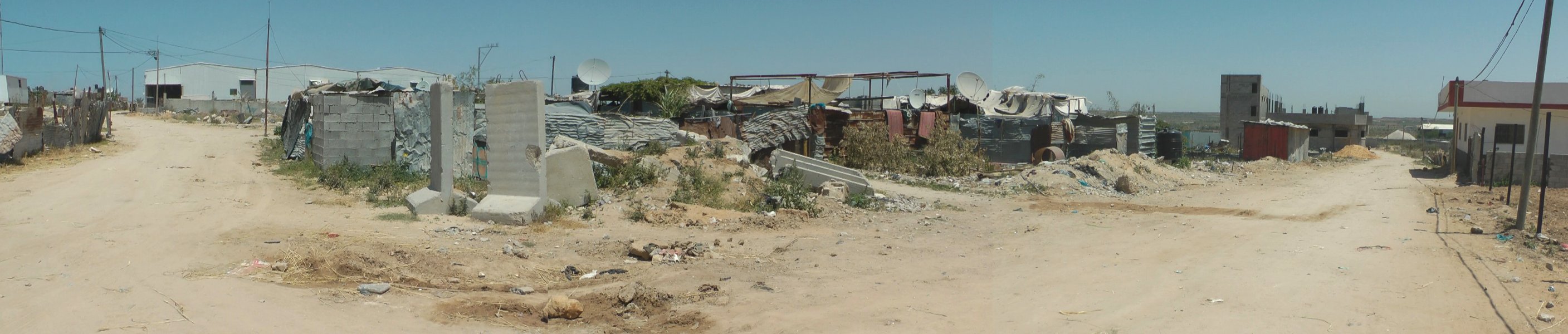 I went into one of the side roads. Some larger houses were under construction there, but there were still plenty of remnants to see from the destruction. 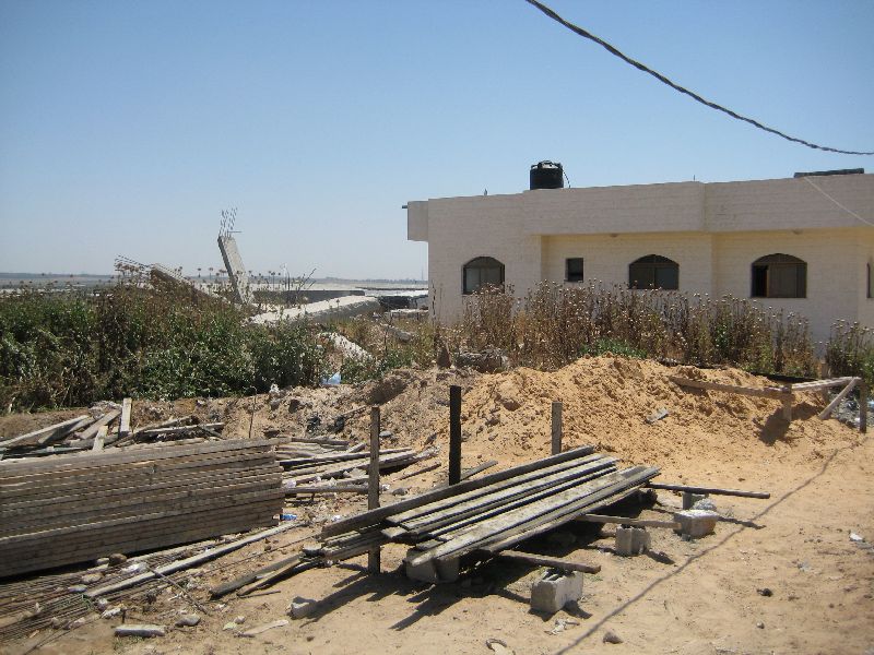
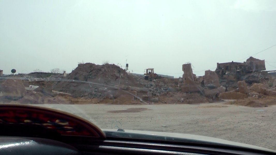
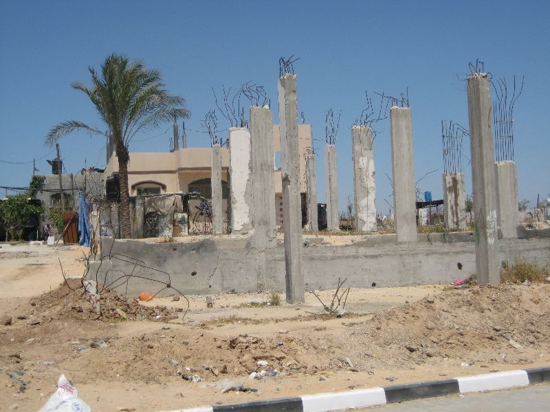 I went across one of the building plots to the parallel path and back to the Al-Quds Street, where I walked up a couple of blocks, and then turned towards area where accumulated red diamonds showed up on the UNOSAT image. Here, to my surprise was very little trace of the events three years back. 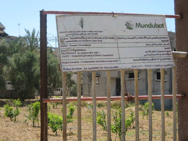
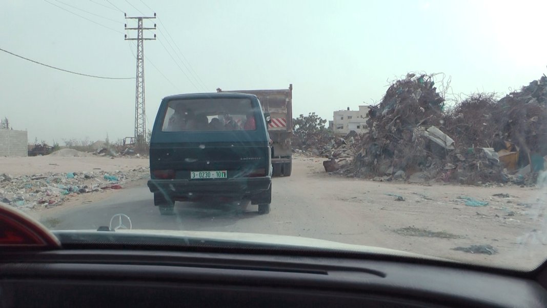
   The young man took me back by car to Gaza City, where I had an appointment. As mentioned above, I went back later to one of the farmers living in the UNRWA shelters. From there we returned via Al Karama Street and Saleh Dardona Street to the city. I filmed a stretch of Al Karama Street and of the beginning of Dardona Saleh St., an absolute moonscape. 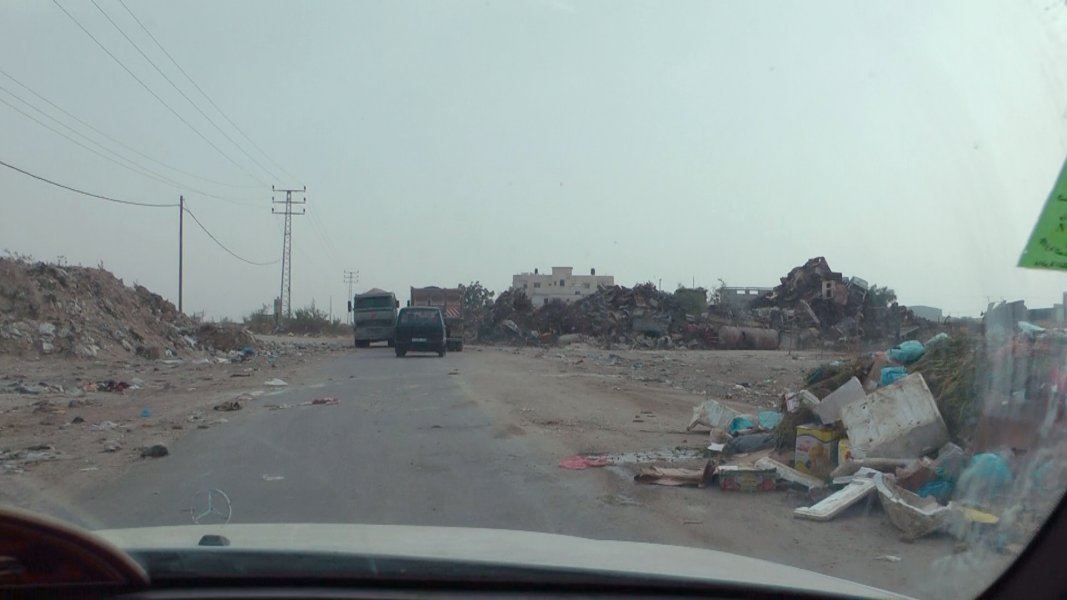
 Al Karama St. 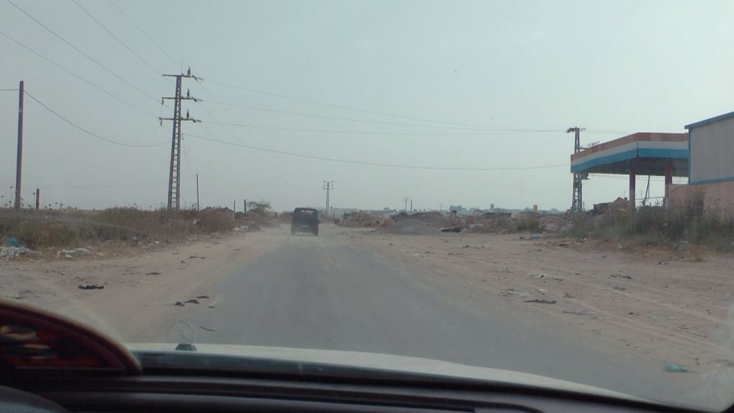
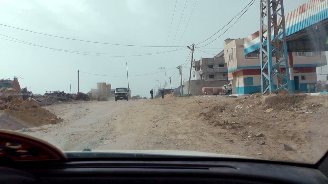 Al Karama St. , Junction Al Karama St. - Saleh Dardona St., Saleh Dardona St. 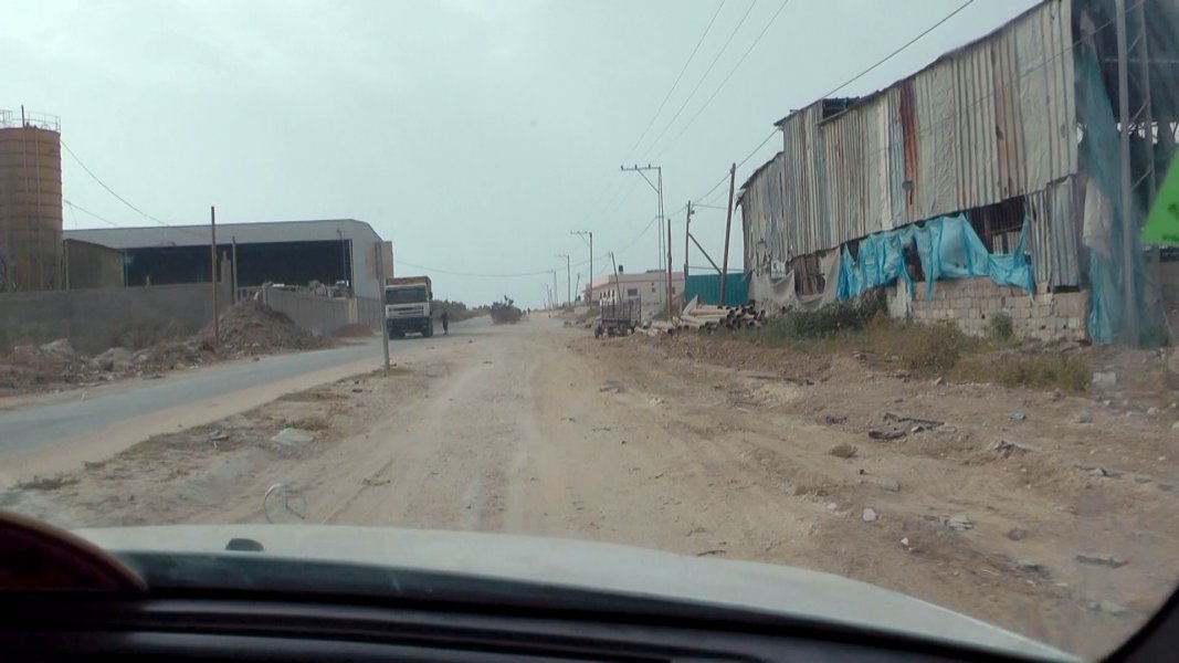
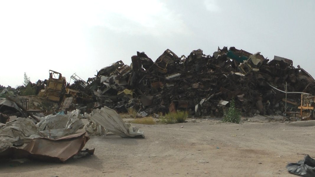
 Dardona Saleh St., a strange monument next to the hall on the left hand side |